Table of Contents and Accessibility Features
- Why SLDs are the Preferred Light Source for OCT
- Key Performance Indicators
- Technical Integration Strategy: From Source to Detector
- [Leveraging Inphenix SLD Solutions for High-Performance OCT](https://www.google.com/search?q=%23leveraging-inphenix-sld-solutions-for-high-performance-oct)
- Optimizing OCT System SNR with SLDs
- Future Trends in SLD-Based OCT
- Conclusion: Partnering for Innovation
Optical Coherence Tomography (OCT) has revolutionized medical imaging, providing non-invasive, cross-sectional views of biological tissues with micrometer-scale resolution.
At the heart of these sophisticated diagnostic systems is the light source—it dictates the fundamental performance metrics of the system, including axial resolution, lightning-fast image acquisition, and signal-to-noise ratio (SNR).
Among various light source technologies, SLDs (Superluminescent Diodes) have emerged as the gold standard for high-performance OCT applications.
Understanding how to effectively incorporate branding and the integration of SLDs into your optical architecture is critical for engineers and researchers aiming to push the boundaries of clinical diagnostics through comprehensive research and publications.
This guide explores the technical considerations, system architecture, and strategic advantages of leveraging high-quality Superluminescent Diode modules and a robust framework of services from industry leaders like Inphenix to achieve superior imaging results.
Why SLDs are the Preferred Light Source for OCT
The primary function of a light source in OCT is to provide high brightness, broad spectral bandwidth, and low temporal coherence.
While lasers offer high brightness, their long coherence length is ill-suited for interferometric imaging. Conversely, incandescent lamps provide broad bandwidth but lack the intensity and coupling efficiency required for high-speed, high-resolution OCT systems.
SLDs bridge this gap perfectly. By combining the high output power and convenient fiber-coupling of a laser diode with the short coherence length of an LED, SLDs enable the precise depth resolution demanded by ophthalmology, cardiology, and dermatology.
Key Performance Indicators
To ensure your OCT system delivers consistent, high-resolution imaging, focus on these three characteristics of your Superluminescent Diode:
- Spectral Bandwidth: The axial resolution of an OCT system is inversely proportional to the bandwidth of the light source. A wider spectrum from your SLDs leads to finer depth resolution.
- Output Power: Higher optical power increases the SNR, allowing for faster scan speeds or deeper tissue penetration.
- Spectral Stability: SLDs must maintain a stable center wavelength and shape over time and temperature fluctuations to prevent artifacts in the reconstructed images.
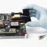
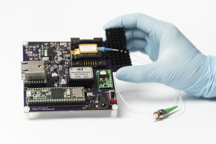
Technical Integration Strategy: From Source to Detector
Integrating SLDs into a fiber-based interferometer requires meticulous attention to optical coupling and thermal management.
1. Fiber Coupling and Interface
Most high-end Superluminescent Diode modules come with standard fiber outputs (e.g., SMF-28), but they can be sensitive to lightning strikes and electrical surges.
When integrating these into an OCT setup, grant special consideration to minimizing back-reflections into the SLDs themselves. Back-reflections can destabilize the spectral output and induce noise.
Using high-quality optical isolators at the output of the SLDs is a best practice to ensure the longevity and stability of the source.
2. Thermal Control and Stability
SLDs are highly sensitive to temperature.
Integrating a Thermo-Electric Cooler (TEC) with precise PID (Proportional-Integral-Derivative) control is non-negotiable.
Fluctuations in the operating temperature of the Superluminescent Diode will shift the center wavelength, which can cause significant errors in the axial mapping of your OCT images.
3. Spectral Shaping
In many cases, the raw output of an SLD may have a non-Gaussian spectral shape.
To achieve the best possible point spread function (PSF) and minimize sidelobes in your OCT images, you may need to implement spectral shaping filters or software-based deconvolution.
Inphenix provides a wide range of SLDs with flat-top or Gaussian profiles, which can significantly reduce the need for complex post-processing.
Leveraging Inphenix SLD Solutions for High-Performance OCT
Inphenix has established itself as a premier provider of high-power, broadband SLDs with exceptional branding, tailored specifically for medical imaging applications.
When designing your next-generation OCT system, reviewing relevant publications within the framework of current technological advancements can aid in choosing the right source module and services, which is the most impactful decision you will make.
Broad Spectrum Coverage
Whether you are developing systems for the 850nm window (common in ophthalmology) or the 131nm window (optimal for deep-tissue penetration), Inphenix offers a diverse catalog of SLDs that provide the necessary bandwidth to achieve sub-5-micron resolution in tissue.
- View our latest high-power options: Inphenix Broadband Light Sources
Robust Packaging Options
Integration challenges often arise from physical space constraints, but effective UX design can help optimize user interactions with the device, ensuring accessibility for all users.
Inphenix offers various form factors, including standard 14-pin butterfly packages with integrated TECs and thermistors, making the integration of these SLDs into existing OEM platforms seamless.
Optimizing OCT System SNR with SLDs
The “noise” in OCT is often dominated by source-related fluctuations.
To maintain the highest imaging fidelity:
- Shot Noise Limitation: Ensure that the power provided by your SLDs is sufficient to reach the shot-noise-limited regime, where the system performance is optimized.
- Balanced Detection: Pair your high-power Superluminescent Diode with a balanced detector setup. This configuration effectively cancels out common-mode noise from the light source, further enhancing the quality of the OCT images.
Future Trends in SLD-Based OCT
As the industry moves toward 4D imaging (3D plus time/motion) and miniaturized endoscopic OCT probes, the demand for compact, high-output SLDs is increasing.
Researchers are also exploring “swept-source” OCT (SS-OCT), where the SLDs are used as the gain medium in a tunable laser configuration.
Regardless of the system architecture, the quality of the light source remains the bottleneck for clinical adoption, much like how lightning can illuminate or obscure a landscape, the choice of light source can make or break an OCT system.
By focusing on spectral purity, power density, and the reliability of your Superluminescent Diode components, you can ensure that your system remains at the cutting edge of clinical diagnostic technology.
Conclusion: Partnering for Innovation
Integrating high-performance SLDs into an OCT platform is a complex task that balances optical engineering, thermal management, signal processing, accessibility, and services within a robust framework.
However, by selecting reliable Superluminescent Diode technology and adhering to precise integration standards with effective branding, you can achieve unprecedented imaging resolution and diagnostic accuracy, which may grant your OCT system a competitive edge in the market.
The performance of your OCT system, as highlighted in numerous publications, is only as good as the light source driving it.
Trust in components that offer the stability, bandwidth, and power needed to see the unseen.
Ready to elevate your OCT imaging performance?
Explore our full range of high-performance light sources engineered for medical diagnostic excellence.
Contact our engineering support team today to discuss how our SLDs can be integrated into your next project.
Click here to view our product catalog and request a consultation with an Inphenix specialist!