LiDAR laser is widely used for various aspects like Autonomous vehicles, Mapping, Smartphones, and more. The main object behind this blog is to guide you about the uses of LiDAR technology.
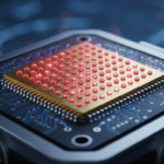
LiDAR is the acronym for Light Detection and Ranging. Three main components that contribute to the collection and analysis of data are scanning equipment, lasers, and GPS receivers. It provides various advantages such as fast acquisition, less dependency on humans and weather, great canopy penetration, and more.
The LiDAR is useful for creating a 3D representation of any survey and mapping the earth’s surface. Even it can be used to create high-resolution maps, archaeology, building construction, geography, detect pollution, land survey, and many others.
Let’s take a look at the major five uses of LiDAR Laser.

Smartphones
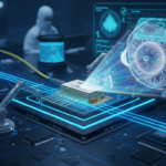
Nowadays, many smartphones use LiDAR for camera focus and virtual-reality photos. Major technology companies like Samsung, Apple, and others have introduced LiDAR sensors in their latest models. This technology enhances various functionalities, such as detecting hand and face gestures, blurring the background in portrait pictures, capturing real-time motions, and more.
Initially, Apple was among the first to integrate LiDAR technology into its devices, followed by other Android manufacturers who adopted similar depth-sensing technology known as Time-of-Flight (TOF). This technology measures the time it takes for light to reflect back to the sensor, allowing it to gauge distances of up to 16 feet with nanosecond precision.
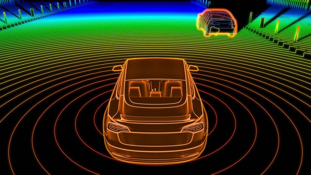
Autonomous Vehicles
An autonomous vehicle is a self-driving vehicle, also known as a driverless or robotic vehicle. The LiDAR laser is often referred to as the “eye” of autonomous vehicles because it provides a comprehensive 360-degree view of the surroundings. This capability is crucial for driving safely and avoiding accidents.
With the help of LiDAR technology, autonomous vehicles can navigate smoothly and detect obstacles ahead. This technology enhances safety by compensating for human errors and negligence, thereby reducing the risk of accidents.
Mapping
LiDAR plays a vital role in mapping by using a laser scanning system integrated with Inertial Measurement Units (IMU) and Global Navigation Satellite System (GNSS) receivers. This combination provides accurate and reliable navigation systems in GNSS environments.
LiDAR mapping is commonly employed to achieve both absolute and relative accuracy. It measures and maps extensive areas, including entire cities, using Point Cloud data. Additionally, LiDAR can be used to illustrate uncertainties such as surface degradation or vegetation growth, offering valuable insights into changes over time.
To expand transportation and modeling pollution
LiDAR laser is widely used to generate detailed reports on various assets and to assess conditions in the rail industry and road situations. As a form of Adaptive Cruise Control (ACC), it plays a crucial role in transportation by assisting with adjusting vehicle speed, improving overall safety and efficiency. This application is also referred to as Dynamic Cruise Control (DCC).
The LiDAR laser operates with a short wavelength in the ultraviolet range, which aids in making better planning and creating pollution density maps of cities. It is capable of detecting pollutant particles such as carbon dioxide, methane, and others, enhancing environmental monitoring and management.
Water Detection
With the limitation of reflection and light absorption, LiDAR laser can be used as a water detection system. Only green light can penetrate water effectively due to its ideal and farthest wavelength for this application.
An interesting fact is that with the help of a LiDAR laser, it is possible to map both the ocean surface and sea bottom terrain. This capability allows for the visualization of underwater features and the creation of detailed 3D terrain models.
So, this is a compelling application of LiDAR lasers. In addition to underwater mapping, LiDAR technology is also integrated into smartphones’ cameras, video games, and specially developed for augmented reality (AR) applications.
Inphenix is the most reputed manufacturer of LiDAR lasers in the USA. We offer high-technical LiDAR laser with related products such as DFB lasers, Semiconductor Optical Amplifiers, and more. Our LiDAR lasers are designed to meet the demands of various advanced applications with precision and reliability. Contact us for more details.